Views: 0 Author: Site Editor Publish Time: 2026-10-13 Origin: Site

Transitioning from manual sampling to real-time data requires more than just purchasing basic hardware. It demands architecting a resilient data pipeline capable of surviving harsh aquatic environments over long periods. Unfortunately, poorly specified systems inevitably lead to critical data gaps during severe algal blooms or sudden stratification shifts. You also risk intense maintenance burdens due to rapid biofouling and face potential non-compliance regarding strict regulatory standards.
This article provides engineers and water resource managers with a proven, step-by-step framework to navigate these exact challenges. We will guide you through evaluating, specifying, and deploying a highly reliable infrastructure tailored to your site's unique topography. You will learn how to align monitoring objectives accurately, select appropriate sensor payloads, and mitigate severe environmental risks effectively.
Define success criteria early: Differentiate between compliance reporting, early warning systems (like Harmful Algal Blooms), and general ecological baseline monitoring.
Prioritize anti-fouling technology and power autonomy to reduce operational expenditures (OpEx) and minimize calibration trips.
Select telemetry based on the specific topography of the reservoir to ensure uninterrupted data transmission.
You must establish clear objectives before reviewing any hardware catalogs. Every successful reservoir water monitoring project begins by isolating the primary operational goals. These goals dictate every subsequent engineering decision.
Different facilities require real-time data for vastly different reasons. You need to identify your primary business driver to avoid over-engineering or under-specifying your equipment.
Regulatory Compliance: Municipalities must meet specific federal drinking water standards. You need verifiable, highly accurate data streams to satisfy environmental agencies. Regulatory applications demand high-precision sensors and rigorous calibration schedules.
Early Warning & Event Detection: Real-time alerts protect public health effectively. Harmful Algal Blooms (HABs) develop rapidly under specific temperature and nutrient conditions. Sudden turbidity spikes often indicate severe agricultural runoff issues. Dissolved oxygen (DO) crashes require immediate intervention to prevent massive fish kills.
Process Optimization: Modern facilities feed environmental data directly into central SCADA networks. Water treatment plants use this upstream data to adjust chemical dosing dynamically. This proactive approach saves chemical resources and improves overall facility safety.
You must decide between deploying a single central unit or a network of distributed spatial monitors. A single unit provides a general baseline near a dam or intake structure. However, large reservoirs often exhibit complex micro-climates. These distinct zones might require a multi-site network to capture accurate hydrodynamic models.
Next, define your required sampling frequency. Taking readings every 15 minutes consumes significant battery reserves. Hourly intervals save power but reduce data granularity during rapidly evolving weather events. You must balance data resolution against your available power budget.
Evaluate your baseline assumptions transparently. Assess your site's existing infrastructure before finalizing any plans. You must guarantee safe access for maintenance boats during all seasons. Analyze baseline seasonal weather conditions carefully. Heavy winter storms or intense summer heatwaves dictate the physical durability required for your equipment.
Common Mistake: Purchasing highly complex sensors without securing a dedicated maintenance team. Advanced optical sensors require knowledgeable technicians to manage data drift and perform routine validations.
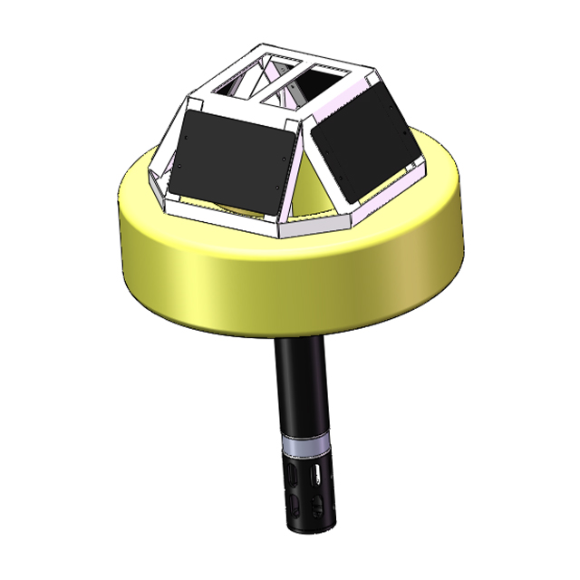
Building a reliable architecture requires selecting compatible, robust components. Every element must work harmoniously to survive continuous outdoor exposure. You can deploy a highly effective multiparameter buoy system by evaluating four critical categories.
You must balance platform stability against deployment logistics. A larger platform handles aggressive wave action easily and supports heavier power banks. However, bulky platforms complicate launch procedures. You might need specialized cranes and large vessels to deploy them safely. Conversely, smaller platforms deploy quickly but struggle in high-wind environments. You must match the platform size to your reservoir's maximum fetch and expected wave height.
Selecting the right sensors directly determines the value of your data. We categorize sensors into standard baseline metrics and advanced situational metrics.
Chart: Standard vs. Advanced Payload Configurations
Parameter Category | Sensor Types | Primary Application | Maintenance Frequency |
|---|---|---|---|
Standard | Temperature, Conductivity, pH, DO, Turbidity | General ecological baselines, daily reporting | Moderate (monthly validation) |
Advanced | Phycocyanin, Chlorophyll-a, fDOM, Nitrate, Ammonia | Algal bloom warnings, pollution tracking, nutrient loading | High (frequent cleaning & calibration) |
Standard parameters form your ecological baseline. Advanced parameters target specific biological or chemical threats. Phycocyanin and chlorophyll-a sensors detect blue-green algae concentrations before visual blooms appear. Fluorescent Dissolved Organic Matter (fDOM) sensors track organic matter loading. Nutrient sensors measure nitrate and ammonia levels directly tied to agricultural runoff.
Power autonomy determines deployment success. You must size solar panels correctly based on your geographic latitude. Calculate battery bank capacity to survive worst-case scenarios, such as two weeks of heavy cloud cover. Smart power management modules ensure continuous operation during these dark periods. They automatically throttle transmission frequencies to conserve battery life until sunlight returns.
Modern data loggers process information directly at the edge. They store collected data locally inside the hull. This local storage prevents catastrophic data loss during cellular transmission outages. Edge processing also filters wild anomalies automatically. If a piece of debris blocks a sensor momentarily, the edge processor flags the outlier before transmitting bad data to your control room.
Selecting reliable equipment requires scrutinizing several technical dimensions. You must evaluate how the equipment handles the reality of the aquatic environment.
Biofouling stands as the single highest cause of data drift. Algae, barnacles, and zebra mussels colonize submerged surfaces rapidly. This growth blinds optical sensors and alters chemical readings. You must prioritize biofouling prevention above all other features.
Evaluate mechanical wipers thoroughly. Central wiper brushes sweep sensor faces before every reading. Copper tape and specialized copper mesh guards deter marine growth chemically. Ultraviolet (UV) anti-fouling technologies offer modern, non-contact alternatives. UV light prevents biofilms from forming entirely. Using a combination of mechanical wipers and copper guards yields the best long-term results.
A functional online water monitoring system relies on consistent communication. You must choose a telemetry protocol matching your site's physical geography.
Cellular (4G/LTE/5G): Cellular offers highly cost-effective transmission. However, it relies entirely on local tower coverage. Deep reservoir valleys frequently block cellular signals, causing frustrating intermittent dropouts.
Satellite: Remote locations demand satellite communication. Satellite guarantees coverage regardless of local topography. Yet, you will face higher latency and significantly increased data transport costs.
LoRaWAN / Radio: Radio technologies work perfectly for direct line-of-sight transmission. You can beam data securely to a local treatment plant without paying recurring cellular fees. This requires placing a receiver antenna at a high elevation point.
Software integration determines how easily your team uses the collected data. Check Application Programming Interface (API) availability early in the process. Ensure the hardware supports standard industrial protocols like Modbus or DNP3. These protocols guarantee compatibility with your existing SCADA or Geographic Information Systems (GIS).
Clarify vendor terms regarding cloud hosting versus local server deployment. You must retain full ownership of your data at all times. Avoid vendors locking your raw data behind proprietary paywalls.
Verify manufacturer credibility relentlessly. Assess their track record deploying equipment in similar limnological environments. Review their warranty terms closely. Read the fine print regarding sensor degradation. Finally, confirm the availability of localized technical support. Waiting weeks for replacement parts during a critical algal bloom destroys the value of real-time monitoring.
Theoretical planning meets physical reality during deployment. You must anchor the equipment securely and protect it from aggressive environmental hazards.
Mooring design dictates physical survival. You must choose between single-point or two-point mooring configurations. Single-point mooring allows the unit to spin freely, which works well in deep, open water. Two-point mooring restricts movement, keeping the platform locked in a specific orientation.
You base this decision on water depth variations, localized currents, and your required swing radius. Always calculate the correct scope ratio. The mooring line must be sufficiently longer than the maximum depth to absorb wave energy without pulling the hull underwater.
Managed reservoirs experience significant seasonal drawdown. Dam operators release massive volumes of water, lowering surface levels drastically. You must account for these extreme changes in your mooring calculations. Proper slack management prevents the water quality monitoring buoy from grounding. Grounding destroys sensitive optical lenses and snaps delicate pH reference junctions instantly.
Anticipate severe environmental hazards proactively.
Ice Formation: Expanding surface ice crushes hollow structures. If your reservoir freezes solid, you must implement seasonal retrieval protocols. Pull the equipment out before the first hard freeze.
Vandalism and Theft: Remote equipment attracts unwanted attention. Utilize tamper-proof hardware on all external hatches. Select low-profile designs to reduce visibility from the shoreline. Remove obvious branding to deter curious boaters.
Extreme Weather: High winds generate violent wave action. Ensure your chosen hull material withstands repeated impacts from floating debris.
Plan your deployment logistics thoroughly months in advance. Secure appropriate vessel requirements early. Small platforms fit on flat-bottom boats, but large units demand pontoon barges.
Perform strict laboratory calibration procedures prior to launch. Never calibrate sensors on a moving boat. Establish clear safety protocols for all personnel handling heavy anchors and chains on the water.
Selecting a dependable buoy water quality monitoring system requires diligent filtering. Do not base your final decision solely on marketing brochures. Follow this logical shortlisting framework to identify the most robust engineering solution.
Begin by filtering vendors based on documented sensor accuracy and field-proven anti-fouling capabilities. Reject any system lacking integrated mechanical wipers or copper guards. High-accuracy sensors mean nothing if they become coated in algae within three days. Ask for long-term drift specifications, not just day-one laboratory accuracy.
Evaluate telemetry options strictly against site-specific signal tests. Do not trust generic cellular coverage maps. Coverage maps predict signals at ground level, not necessarily down inside a steep reservoir valley. Send a technician onto the water to test actual signal strength at the exact proposed deployment coordinates.
Demand documented maintenance intervals from prospective vendors. Ask for long-term reliability metrics from actual field deployments. You need a system designed for extended autonomous operation. Vendors should clearly state how often technicians must visit the site to refill calibration solutions or replace consumable reference junctions.
Conduct a pilot deployment before committing to a massive network rollout. Rent or lease a single unit for a three-month trial. Expose it to your specific water chemistry. Measure how much biofouling accumulates. Review peer case studies carefully. Look for examples where the vendor successfully deployed equipment in similar limnological environments. This empirical testing validates the hardware's real-world capabilities.
A successful real-time data project requires rigorous site assessment and highly realistic maintenance planning. You must select hardware engineered specifically for your reservoir's unique environmental challenges. Defining clear objectives prevents over-engineering and keeps the project focused on actionable data.
Begin your deployment journey by conducting a comprehensive site survey. Map out cellular dead zones, analyze wave fetch, and calculate drawdown risks accurately. Always pilot a single, fully equipped multiparameter unit before attempting to scale into a complex multi-site network.
Take action today to secure your water resources. Consult directly with an experienced integration specialist. Request a site-specific telemetry test and a detailed power budget analysis to ensure your system performs flawlessly year-round.
A: It typically requires calibration every 4 to 8 weeks. This timeframe depends heavily on your specific water's biofouling potential. Highly effective integrated anti-fouling wipers and copper guards can extend this interval safely. Regular field validation checks help determine your optimal schedule.
A: Yes, most modern telemetry platforms support standard industrial protocols. You can use Modbus or DNP3 to connect directly. Many systems also offer secure REST APIs. This allows for seamless, real-time control room integration and automated chemical dosing adjustments.
A: Optical sensors measuring dissolved oxygen or turbidity can last 3 to 5 years with proper cleaning. However, consumable sensors like pH and ORP probes degrade chemically. These typically require complete replacement every 12 to 18 months, regardless of cleaning schedules.
A: You prevent drifting by utilizing a properly calculated mooring architecture. Engineers employ heavy bottom anchors and subsurface floats to keep the line taut. They calculate specific chain lengths to accommodate maximum depth fluctuations without submerging the platform.